


As one of the wildest landscapes in the country, there are tons of unique Colorado hikes that you’ll have a hard time comparing to anything else you’ll find in the country. Here’s a collection of a few of our favorite “weird” hikes around the state, ranging from beginner trails to much more difficult routes. Don’t bite off more than you can chew.
1. Hike to Castle Ruins
Nestled on Mount Falcon near Morrison, you’ll find the remains of a castle that once stood three-stories tall. Inhabited by John Brisbane Walker in the early 1900s, the structure fell into ruin after a strike of lightning hit it in 1918. If you’re looking to hunt this one down, you’ll need to find the Mount Falcon Trail, approximately 2.3 miles long.
LEARN MORE: The Mount Falcon Castle Ruins!
2. Hike to the Dam that Flooded Denver

Castlewood Dam ruins can still be found in Castlewood Canyon State Park. Photo Credit: Colorado Parks and Wildlife.
Remember that one time Denver was buried under four feet of standing water? Probably not…it happened in 1933. However, if you head over to Castlewood Canyon State Park, you’ll be able to see the remains of the dam that broke and caused it all. To find the Castlewood Canyon Dam, you’ll want to enter the park through the western entrance. From there, it’s an easy 0.3 mile hike.
LEARN MORE: This Dam Broke and Flood Denver with 4 Feet of Water!
3. Hike to an Aircraft Crash Site

Plenty of trails that are perfect for fall Colorado hikes cross through the Pike National Forest. From the highest elevations of North Cheyenne Canon Park you can see – and connect to trails up – Almagre Mountain.
Several planes have crashed in Colorado over the years because of the state’s unpredictable weather and tricky mountains to navigate. Many of these crash sites are in places so remote that removal of debris is too difficult, thus the metal remains of the planes have stayed where they fell. One crash site that’s relatively easy to find is the UH-1 Huey Helicopter crash site near Colorado Springs. To find it, you’ll head to the northern bump of Almagre Peak. The wreck is on the northern side of the boulder field. If you’re seeking out this wreck, or any other aircraft crash site, we recommend that you get a detailed map and do your own research on the exact route, meticulously noting the coordinates of where you’re headed. As most crash sites are very remote, finding them can be dangerous. Additionally, treat these crash sites with respect and always leave no trace.
RELATED: 4 Aircraft Crash Sites to Track Down!
4. Hike to Dinosaur Tracks

Dinosaur prints at Picketwire Canyonlands in eastern Colorado.
You’re going to need to be in shape for this one. The Colorado hike is over 10 miles round trip, but so worth it. If you head over to southeastern Colorado’s Picketwire Canyon, you’ll find the Purgatoire River Track Site, a stretch of over 1,300 dinosaur tracks. You’ll literally be walking the same path as these enormous beasts from yesteryear.
LEARN MORE: Colorado’s Dinosaur Highway!
5. Hike to a Ghost Town

The beautiful Crystal Mill near Marble on a summer day. Photo Credit: Adam-Springer.
While there are plenty of ghost towns all around the state of Colorado, one of the most iconic abandoned spots is the town of Crystal. Its most notable structure is the Crystal Mill. If you want to get a picture of this spot for yourself, you’ll need to trek 5.5 miles down a very bumpy dirt road. Some people will drive this with a 4×4 vehicle, though most seem to hike it.
FIND MORE: 9 Awesome Colorado Ghost Towns!
6. Hike to a Hidden Cove

Paradise Cove, Guffey, Colorado. Photo Credit: Spencer McKee
Called a couple different names, Guffey Cove (or Paradise Cove) is a popular destination for cliff jumpers from all around the state. You’ll have to hike a little over a mile to get there, but as the trail opens up to deliver a beautiful view of the cove below, you’ll know this remote destination was worth the trek. The area is surrounded by several cliffs and a stunning canyon to explore. If you plan on cliff jumping, do so at your own risk. This is a dangerous sport and water levels of the cove tend to vary depending on the season. Note: New rules now mean a $6 per vehicle fee, along with no alcohol or amplified music.
RELATED: Cliff Jumping at the Devil’s Punchbowl!
7. Hike Along the Continental Divide

Loveland Pass Summit in Winter. Colorado, United States.
While the Continental Divide Trail (a route from Mexico to Canada) stretches for more than 650 miles in Colorado, one of the easiest places to access it is at the top of Loveland Pass. You can drive to the top of this pass at 11,990 feet before disembarking from your car to explore the surrounding area. As you reach the high point on the Continental Divide ridge, you can pour a little water off of one side and it will eventually find its way to the Atlantic Ocean, while pouring some off of the other side will send some water to the Pacific.
READ MORE: Snowmobiling at the Continental Divide!
8. Hike to Decaying Mountain Shelter
Built in the 1920s, the Notch Mountain stone cabin is an iconic sight for many climbers seeking to summit Mount of the Holy Cross. Originally built on the southern ridge of Notch Mountain to provide an overnight shelter for visitors and climbers, this is also where the famous snow cross on Mount of the Holy Cross was first photographed.
RELATED: How the 14ers Got Their Names!
9. Hike Along A Cliffside

Via Ferrata, Telluride, Colorado.
Ever want to test your nerves on the wall of a cliff hundreds of feet off the ground? If so, Telluride’s Via Ferrata is your best bet. As climbing meets hiking, brave souls willing to try this one clip in and walk along small footholds in the rock. It’s not for those scared of heights. That being said, if you can muster up the courage to conquer this one, you’ll see one of the most beautiful views Telluride has to offer, including Bridal Veil Falls. If you’ve never done this hike, we encourage you to go on a guided trip with a professional guide service like San Juan Mountain Guides.
READ MORE: Telluride’s Scariest Hike!
10. Hike Through A Canyon
This one is perhaps the most intense hike on our list. If you want a really unique view of the Black Canyon of the Gunnison, you’ll find it at the bottom of this 2,000-foot gorge. You’ll need a permit to do this legally and the human-sized poison ivy plants that grow on the canyon floor will be the least of your worries. You’ll find yourself in a very inaccessible place after a difficult descent, among other wildlife and flash flooding risks. Plan carefully and don’t do this hike if you’re not very experienced. Sounds dangerous, right? But the canyon floor selfie will be worth it.
READ MORE: Colorado’s Darkest Canyon!
11. Hike to the Top of A Volcanic Crater

Photo Credit: Big-g at restlessadventurer.
Believe it or not, Colorado used to have a landscape full of volcanoes. One that you can still visit is the Dotsero Crater, and it’s actually pretty easy to find. Located on the Dotsero-Ute Trail just before Glenwood Canyon on I-70, you’ll need to take exit 133 heading north on Colorado River Road for about a half-mile to find the trail head. If you want to simply hike to the top of the crater and back to the parking area, it will be roughly 1.25 miles round trip. That being said, some of the more adventurous will choose to head to the bottom of the crater. Just make sure you have a solid plan for getting out.
RELATED: Colorado’s Most Hikeable Volcano!
12. Hike Along A Haunted Road

Gates block the 3rd tunnel on Gold Camp Road. Photo Credit: markbyzewski (Flickr).
If you’re looking for a haunted hike near Colorado Springs, a walk along Gold Camp Road can’t be beat. As legend has it, the collapse of one of several tunnels on this route trapped a school bus, resulting in the deaths of all children aboard. While the main road that travels past the collapsed tunnel is more of a road than a hiking trail, it quickly narrows to several routes that sprawl throughout the area. Hikers often report hearing voices and laughter while they’re in the area at night. If you’re looking to park closest to the collapsed tunnel, use the upper lot past Helen Hunt Falls on Cheyenne Canyon Road and head northwest down Upper Gold Camp Road. Be warned that this area is relatively prone to accidents amongst hikers, as several tall cliffs and loose rock can be found nearby.
READ MORE: The Horror Story Behind The Gold Camp Road Tunnels!
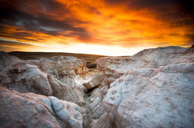
13. Hike Around An Otherworldly Landscape

Paint Mines Interpretive Park. Photo Credit: Charles Roach.
Relatively hidden in the small town of Calhan, a walk around the Paint Mines Interpretive Park makes for one of the most unique hikes in the state. Once you park, head straight for the rock features so that you can explore multicolored spires unlike anything else you’ll find in the state.


(0) comments
Welcome to the discussion.
Log In
Keep it Clean. Please avoid obscene, vulgar, lewd, racist or sexually-oriented language.
PLEASE TURN OFF YOUR CAPS LOCK.
Don't Threaten. Threats of harming another person will not be tolerated.
Be Truthful. Don't knowingly lie about anyone or anything.
Be Nice. No racism, sexism or any sort of -ism that is degrading to another person.
Be Proactive. Use the 'Report' link on each comment to let us know of abusive posts.
Share with Us. We'd love to hear eyewitness accounts, the history behind an article.