
The views, the challenge and the bragging rights that come with climbing America’s Mountain combine to make Barr Trail wildly popular. Less traveled is the summit route on Pikes Peak’s backside, from the Crags Trail. And less appreciated is Devil’s Playground, a scenic destination in its own right at almost 13,000 feet. To avoid afternoon storms in the summer, you’ll want to start early to reach this rocky paradise – especially if you intend to continue about 2 more miles to the mountaintop. If that’s the case, consider booking an overnight spot at the Crags Campground near the trailhead near 10,000 feet.

A sign that warns visitors of lightning behavior at Devil’s Playground. Photo Credit: markbyzewski (Flickr).
From the parking lot in Pike National Forest outside Divide, follow the trail that starts by crossing a bridge over a creek. You’ll feel the initial ascent into the woods where the U.S. Forest Service has felled beetle-infested spruce trees in recent years. Don’t let the openness lead you astray on the well-marked dirt tread. In winter, this is a popular area to explore on skis or snowshoes, but be advised that reaching the trailhead during the season will be time-consuming. The Forest Service in 2017 announced it would bar vehicles on a snow-packed Forest Road 383, which leads to the parking lot.
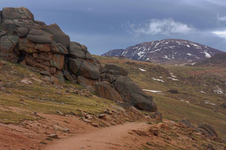
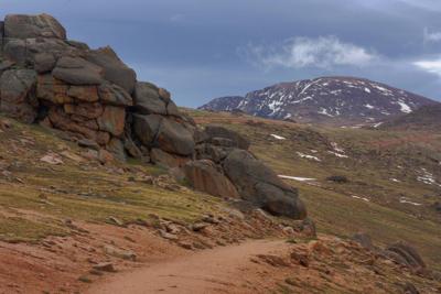
Approaching 1 mile, see the sign pointing to your right to Devil’s Playground. Now the ascent on the wide path becomes relentless, with a few more creek crossings serving as peaceful rest stops. The views open as you get above treeline: The Sangre de Cristos, Sawatch Range, Mosquito Range and Tenmile Range can be spotted on a clear day. The final push up the tundra will burn. Keep your eyes upward, trained on the prize: the rock formations spotting the lush basin. To Pikes Peak, proceed across the highway.
Trip log: 8.6 miles round trip (out and back), 2,987-foot total elevation gain, 12,958 feet max
Difficulty: Difficult
Getting there: Going west on U.S. 24, reach Divide and turn left at the stoplight for Colorado 67 south. Soon after passing the entrance to Mueller State Park, see the post to your left marking Crags Campground. Follow the dirt road to the Rocky Mountain Mennonite Camp cabins. Follow Forest Road 383 to the trailhead.
FYI: Multi-use trail. Dogs on leash. Trails could be icy in winter.


(0) comments
Welcome to the discussion.
Log In
Keep it Clean. Please avoid obscene, vulgar, lewd, racist or sexually-oriented language.
PLEASE TURN OFF YOUR CAPS LOCK.
Don't Threaten. Threats of harming another person will not be tolerated.
Be Truthful. Don't knowingly lie about anyone or anything.
Be Nice. No racism, sexism or any sort of -ism that is degrading to another person.
Be Proactive. Use the 'Report' link on each comment to let us know of abusive posts.
Share with Us. We'd love to hear eyewitness accounts, the history behind an article.