

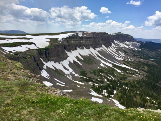
The Devil’s Causeway, located in the Flat Tops Wilderness, is a rarely talked about Colorado gem. Resembling a massive wall rising up from the landscape, this is one of the most unique geological features in the state. The ridge runs between the drainage of William Fork River and White River, frequently visited by the bravest outdoorsmen and women around.

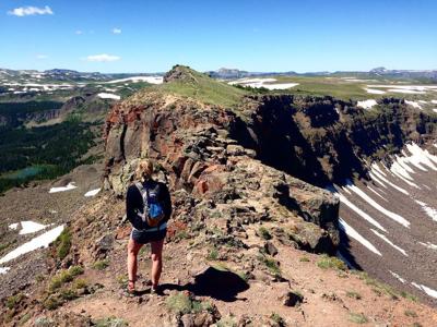
The OutThere Colorado social media guy tackles the narrow section of the Devil’s Causeway Trail.
The narrow ridge is only accessible by hikers, many of which typically start at a trail near Stillwater Reservoir.
RELATED: These Colorado cliffs look like books on a shelf
At an elevation of 11,800 feet and with a chilling width of only four feet in some places, this ridge hike isn’t for the faint of heart.

This photo shows what type of terrain is found in the area. Photo Credit: Spence McKee
The drops on each side vary, but can be as much as several hundred feet.
If you want to attempt the hike yourself, look forward to amazing views. Just be careful with the uneven footing and very dangerous cliffs.
RELATED: 40 Must-See Colorado Destinations
If you’re curious about where the Devil’s Causeway is located, here’s a map from our headquarters in Colorado Springs.


(0) comments
Welcome to the discussion.
Log In
Keep it Clean. Please avoid obscene, vulgar, lewd, racist or sexually-oriented language.
PLEASE TURN OFF YOUR CAPS LOCK.
Don't Threaten. Threats of harming another person will not be tolerated.
Be Truthful. Don't knowingly lie about anyone or anything.
Be Nice. No racism, sexism or any sort of -ism that is degrading to another person.
Be Proactive. Use the 'Report' link on each comment to let us know of abusive posts.
Share with Us. We'd love to hear eyewitness accounts, the history behind an article.